Internet monitors have detected major disconnections before; there were stories of ping utilities that incidentally mapped the extend of the Internet outage caused by the Loma Prieta earthquake using pings. Our data captured one aspect of NATO bombing of Yugoslavia in the spring of 1999.
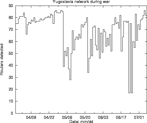
During the first month of the war few if any Internet links were cut. But in early May, the bombing moved to the power grid, and the resulting disconnection is clearly shown in figure 4. The connectivity returned slowly. Incidentally, the reachable routes in neighboring Bosnia also declined. We inferred (correctly) that Bosnia relies largely on the Yugoslavian power grid.
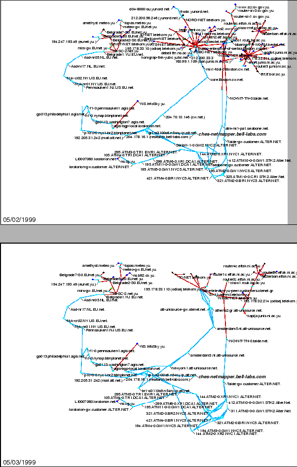
Figure 5 and figure 6 compare May 2nd and May 3rd of the NATO bombing. It is interesting to note two large spiny ``Koosh'' balls in the upper right of the map have been significantly reduced. This would seem to imply that although the core routers at the center of the ``Koosh'' balls were not directly damaged, many of the outlying routers were affected, possibly through power loss.
The maps also reveal that there appear to be only a few distinct routes into the Balkans from our test host. The power of the mapping technology is quickly apparent when viewing the limited number of gateways that appear, showing the connectivity of Yugoslavian domains with the rest of the Internet.
 |
We detected the results of distant damage in an semi-automated way. We doubt that we are the first to consider the military uses. The usefulness is limited, because the exact physical location of most routers isn't known. Related techniques will doubtless be useful for monitoring the extent of other natural disasters, particularly in well-connected parts of the world.